In Fair Haven, Vermont, some sewer lines have served the community for nearly 120 years. Like many long-standing infrastructure systems, the collection system experiences a range of challenges. Aging pipes, deteriorating manhole structures, and unwanted stormwater and groundwater flows place increasing demands on the Town’s wastewater infrastructure.
To understand these challenges, the Town partnered with Hoyle Tanner to evaluate the collection system and develop a practical roadmap for improvement. Historical research, GIS analysis, field inspections, rainfall records, and wastewater flow data were combined to identify the most significant problems and prioritize the work that will provide the greatest benefit.
The result is a phased, data-driven strategy that can help Fair Haven shift into proactively managing one of its most important public assets.
Improving the Map Before Improving the System
A strong understanding of existing infrastructure is an important first step in planning for the future.
The Town had recently begun collecting GPS locations for sewer manholes and developing a digital GIS map. While that effort established valuable surface information, details such as manhole conditions, connectivity, and asset identification were often unavailable. (Check out our full range of wastewater services.)
Building on the Town’s existing GIS work, the team assigned every mapped manhole a unique identifier tied to its street and location. Inspection findings, photographs, recommendations, and mapping can now be connected to specific assets, creating a practical database for maintenance, emergency response, budgeting, and capital planning.
Taking a Closer Look Underground
With foundational mapping in place, the next step was evaluating conditions in the field.
Using a customized ArcGIS Survey123 application, inspectors evaluated approximately 80 sewer structures, representing about 40 percent of the Town’s estimated 200 manholes.
Each inspection documented:
- Structure condition
- Materials and dimensions
- Pipe connections
- Evidence of infiltration or inflow
- GPS locations
- Photographs
The information was incorporated directly into the GIS database, providing a more complete picture of the collection system and its current condition.
What the Inspections Revealed
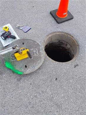
As expected for a system with more than a century of history, the inspections identified a range of conditions, from routine maintenance needs to unexpected findings.
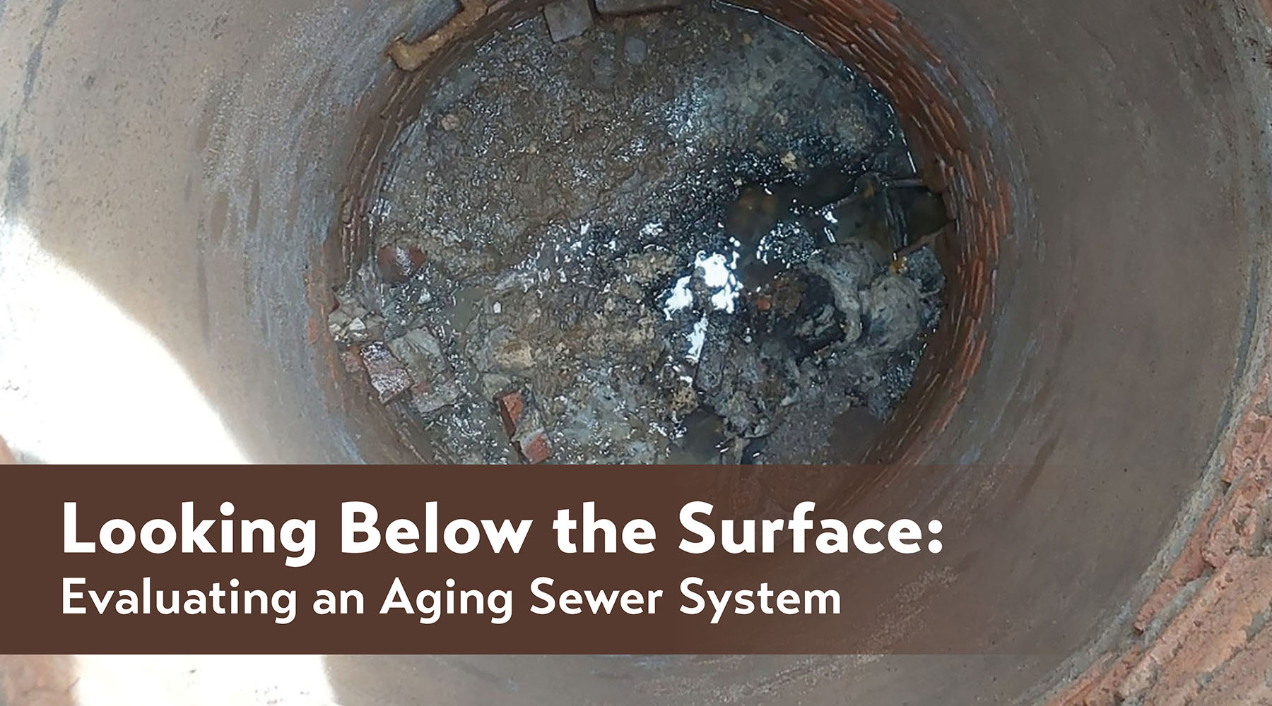
Some structures exhibited signs of deterioration, including eroded benches, falling brickwork, debris accumulation, and aging frames and chimneys. The team also identified abandoned structures that could be removed from active mapping, helping improve the accuracy of system records.
Several discoveries highlighted the value of documenting existing conditions. The inspections still identified a range of needs, including damaged covers and frames, deteriorated chimneys and cones, obstructed benches, debris, and evidence of previous surcharging. Two pipe connections had visible infiltration, and two severely deteriorated manholes were recommended for replacement.
Planning for the Next Phase
Because of annual budget limitations, this initial phase focused on the highest-priority areas and evaluated less than half of the system.
The remaining inspections are planned as part of a multi-year effort. The evaluation gives Fair Haven a practical path forward. Initial priorities include locating and opening inaccessible manholes, repairing covers and frames, raising structures below pavement, and completing inspections during high-groundwater periods.
In the future, recommendations include smoke and dye testing to locate direct inflow sources, while flow isolation or temporary metering to identify the neighborhoods contributing the largest wet-weather flows. Targeted CCTV inspection can then document pipe conditions and guide the selection of rehabilitation methods.
Findings from the work completed to date have been compiled into a Preliminary Engineering Report documenting inspection results, photographs, and recommended improvements. The report also includes a phased capital improvement plan to help Fair Haven prioritize rehabilitation, maintenance, and investigation efforts through summer 2029.
Building a Better Understanding

Infrastructure evaluations are not always about uncovering major failures. Often, their greatest value comes from providing a clearer understanding of systems that have served communities for generations.
For Fair Haven, this effort delivered updated mapping, documented existing conditions, identified deficiencies, and established a phased roadmap for future work.
By investing in a better understanding of its sewer collection system today, the Town is better positioned to manage future challenges, address issues before they become emergencies, and make informed decisions about essential infrastructure for years to come.
Fair Haven’s experience offers an important lesson for municipalities of all sizes: a proactive approach to infrastructure management can save time, money, and resources in the long run.
Rather than waiting for system failures to dictate priorities, communities that assess and understand their assets can make smarter, data-driven decisions, strengthen resilience, and better prepare for future growth and regulatory demands.