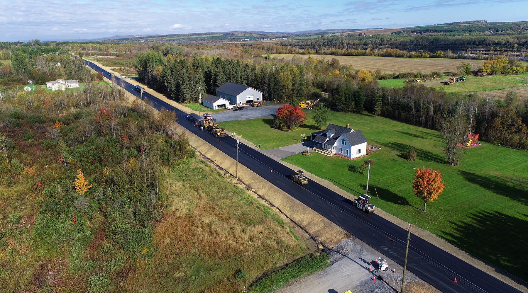
Hoyle Tanner is working to repair the causeway and replace the Crystal Lake Road bridge over the northwest section of Crystal Lake where Nelson Brook enters in the Town of Gilmanton, New Hampshire.

It is unknown when the bridge was first installed, however, we know that it consisted of a timber superstructure* supported on dry-stacked stone masonry abutments constructed along a manmade causeway. The bridge was rehabilitated in 1929 when the superstructure was replaced by a reinforced concrete rigid frame. The replacement bridge will be a precast-prestressed concrete deck beam superstructure founded on a precast concrete cap with deep foundations.
Where Does a Lake Begin?
Since replacing the bridge is going to result in some disturbance, or impact, to the lake on the downstream side of the bridge, a Wetland Permit was required to be issued by the New Hampshire Department of Environmental Services (NHDES). However, as our environmental coordination staff began to complete the permit application, it became evident that one important piece of information was lacking: Where does the shore end and the lake begin?
This may seem to be a pretty simple question to answer – the lake begins at the edge of the water! However, the State of New Hampshire, which has legal authority to regulate and permit work done in lakes, has a set definition of a lake that comes from both New Hampshire RSA 485-A:2 and Chapters 100 and 400 of the NHDES Wetland Rules. Those define a lake as a surface water with the normal high water line as the elevation of the boundary between a lake and upland or shore. For most naturally-occurring lakes or ponds (that have not been created by a dam), a licensed surveyor can visit the site of the proposed work area and use visual evidence to determine the water elevation where under normal or typical conditions the waters of the lake are at their highest on the adjacent bank or shore.
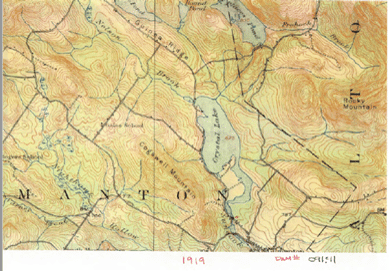
But for Crystal Lake, there are factors to consider that made this a bit more challenging. Crystal Lake is approximately 450 acres in size, making it large enough to be considered a public water per New Hampshire RSA 271:20 II: Public waters in New Hampshire include natural or artificially impounded (dammed) surface water bodies that are over 10 acres in size. NHDES issues an Official List of Public Waters (OLPW) that includes data for each water body such as location, dammed status (dammed or not?), the Dam Bureau number if it is dammed, and for some water bodies, the normal high water line/elevation. Crystal Lake in Gilmanton is listed as RD or raised by damming, Dam # 91.11, without providing a normal high water elevation. Why not?
A lake that is noted as RD is a water body that was a natural lake that was more than 10 acres in size originally, but at one point the water level has been elevated by construction of a dam at the outlet, or “raised by damming.” Per the RSA and NHDES rules, only the areas of land underwater that are below the original normal high water elevation before the lake was dammed are Public Waters. Because there is not elevation provided on the OLPW, that elevation has not been officially determined by NHDES. How do you determine that elevation? By doing quite a bit of sleuthing!

Establishing a Timeline
For Crystal Lake, we enlisted the assistance of both the local surveying team, Sandford Surveying and Engineering, Inc., and our in-house super-sleuth and Right-of-Way acquisition specialist, Betsy Bosiak. Together, they reviewed current and historic mapping such as tax maps, USGS maps and survey plans for lots around the lake as they were recorded as sold or subdivided. In addition, deed records were reviewed for when the land near the dam and bridge changed ownership; other local Town records were reviewed and local authorities were interviewed. Historic books and internet sites were also scoured for any available historical information. From this collective information, our team was able to determine that the dam has been in place for at least 100 years and a timeline of ownership for the property along the lake was established.
Data from the time of the dam’s installation was gathered and reviewed in detail to glean any water elevation data that could provide the water elevations in the lake before the dam was installed.
The first available plans for the dam come from references to notes that were unable to be found, however the first photo of the dam was found dated July 1934, so we believe that the dam was installed around that time.
Careful review of plans from 1957 for a dam reconstruction project provided enough information to determine the natural mean high water elevation before damming was 617.2 feet – this was based on plan figures showing the bottom elevation of the dam to be set at 616.7 feet, with an assumed normal flow depth of 6 inches. To compare that to current conditions, the water elevations for the full lake conditions (that is, when the lake is reached its maximum volume as regulated by the dam) is 624.25 feet, or more than 7 feet deeper than the historic water levels!
The History Mystery Took…A While
Identifying this elevation took over six months! Ultimately, all of the supporting data that was used to “tell the story” was provided to NHDES in order for the Dam Bureau and the Wetlands Bureau to determine if the proposed elevation could be used for identifying impacts to the lake and Public Waters of the State of New Hampshire. NHDES ultimately concluded and agreed with the water elevation that we presented based on the depth of supporting evidence that was uncovered.
Identifying such an important piece of information was quite a challenge for our team; however, we were able to meet this challenge while keeping the project on schedule and within the Town’s expectations of cost. Additionally, Hoyle Tanner’s bridge design team worked hand-in-hand with the environmental coordination team to successfully design a bridge replacement project that resulted in no impacts to Public Waters of the State.


!["[At Hoyle Tanner] there is a strong encouragement to keep growing professionally, and no one hesitates to help when you have questions or are learning something new. That positive approach to development creates an environment where people feel comfortable challenging themselves and building new skills." - Marko Salih](https://hoyletanner.com/wp-content/uploads/2026/07/Featured-Images_Marko.jpg)